CASTLE VIEW
Posted: 19 Feb 2016, 07:22
CASTLE VIEW
What's in a name? Quite a lot actually as they often give us clues to history and forgotten history at that. Think of field names like Causeway Carr behind Bancroft Shed, one of the first clues I got to the existence of the Bronze Age track way through the town. Havre Park, named after the oats that used to be grown on that rich bottom land and as I found out later, exported to Bolton Priory in the 15th century. So it can be very frustrating when you have a name that is obviously some sort of clue but you can't find out what it means. Such a name is Castle View, the small row of cottages just below the Dog that had basement dwellings accessed from a lower level, rather like the houses you find in very hilly areas like Hebden Bridge. The nearest castle I knew of was at Clitheroe but that didn't really look like a candidate!
I've mentioned the work my friend John Clayton is doing using the LIDAR technology that shows clearly variations in the surface of the ground that can't be seen any other way. He's been working on Barlick and coming up with some fascinating insights which show the pattern of habitation over 3,000 years ago. He's been further refining his results and has identified a regular structure on the land now covered by Cobden Street and extending back to include Beech Street as well. John is very experienced in these variations and he says that it has all the hallmarks of being a Roman Fortlet, a small defended enclosure, in other words, a castle. He isn't totally familiar with all the names in Barlick and was intrigued when I pointed out that the row of cottages facing the site was called Castle View. It's obvious that they aren't of Roman origin but I asked him whether he thought the folk memory could have preserved such an association over 2,000 years and he gave me a string of examples he has found of such associations in locations where it was certain that there was a castle in sight. I trust John, his work and his opinions so until someone comes up with a better explanation I'm quite happy to note this possible association as a working hypothesis. Perhaps at last we have an explanation for the name.
Another name cropped up this week which was bothering me but was more easily explained. Can you remember me talking about the meadow on the other side of the canal from the marina? I knew it had a local name but it was eluding me. I have heard Vicky Barritt use it so I rang that fount of all Salterforth knowledge, Nick Livesey. He sorted me out straight away, the name I had got from Vicky was Bob Preston's Meadow but Nick went further, he told me that the original name on Far Hey Farm's deeds is Far Field and Bob Preston was the owner of it at one time. Local knowledge wins every time!
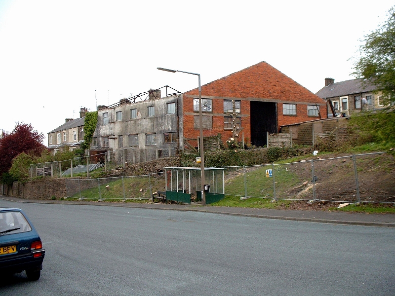
Wild's Garage on the site of the possible Roman Fortlet in 1980.
What's in a name? Quite a lot actually as they often give us clues to history and forgotten history at that. Think of field names like Causeway Carr behind Bancroft Shed, one of the first clues I got to the existence of the Bronze Age track way through the town. Havre Park, named after the oats that used to be grown on that rich bottom land and as I found out later, exported to Bolton Priory in the 15th century. So it can be very frustrating when you have a name that is obviously some sort of clue but you can't find out what it means. Such a name is Castle View, the small row of cottages just below the Dog that had basement dwellings accessed from a lower level, rather like the houses you find in very hilly areas like Hebden Bridge. The nearest castle I knew of was at Clitheroe but that didn't really look like a candidate!
I've mentioned the work my friend John Clayton is doing using the LIDAR technology that shows clearly variations in the surface of the ground that can't be seen any other way. He's been working on Barlick and coming up with some fascinating insights which show the pattern of habitation over 3,000 years ago. He's been further refining his results and has identified a regular structure on the land now covered by Cobden Street and extending back to include Beech Street as well. John is very experienced in these variations and he says that it has all the hallmarks of being a Roman Fortlet, a small defended enclosure, in other words, a castle. He isn't totally familiar with all the names in Barlick and was intrigued when I pointed out that the row of cottages facing the site was called Castle View. It's obvious that they aren't of Roman origin but I asked him whether he thought the folk memory could have preserved such an association over 2,000 years and he gave me a string of examples he has found of such associations in locations where it was certain that there was a castle in sight. I trust John, his work and his opinions so until someone comes up with a better explanation I'm quite happy to note this possible association as a working hypothesis. Perhaps at last we have an explanation for the name.
Another name cropped up this week which was bothering me but was more easily explained. Can you remember me talking about the meadow on the other side of the canal from the marina? I knew it had a local name but it was eluding me. I have heard Vicky Barritt use it so I rang that fount of all Salterforth knowledge, Nick Livesey. He sorted me out straight away, the name I had got from Vicky was Bob Preston's Meadow but Nick went further, he told me that the original name on Far Hey Farm's deeds is Far Field and Bob Preston was the owner of it at one time. Local knowledge wins every time!
Wild's Garage on the site of the possible Roman Fortlet in 1980.